The FIRE-RES project aims to provide the EU with the capacity to manage the projected increase in forest fires under a harsher climate. It will deploy a series of innovation actions across eleven living labs located in Europe and Chile, during the period 2021-2025.
One of these Living Labs is “Landes de Gascogne” in Nouvelle-Aquitaine a triangle of sandy soils, 75% of which is forested, with 1Mha of pine. It is located in the south-west of France. This area of homogeneous nutrient poor sandy soil is dominated by maritime pine stands mainly associated with oak. The high afforestation rate leads to a strong continuity in fire fuel load across the landscape. Most of the forest is managed as regular stands, with strong efforts at weed control to reduce fire risk and improve productivity. Since 1949, there is an extremely efficient prevention system in place with forest owners mandatory enrollment in municipal fire prevention associations (DFCI : défense des forêts contre les incendies). These associations are in charge of installation and maintenance of forest roads, fire-breaks, bridges and drilled wells. These infrastructure resources combined with an increasing fire fighting capacity has meant that the system has worked well since the last war and there have been no megafires despite an ever present risk (5000 fires start per year in Gironde department). The fires are mainly ignited by human activity, lightning representing less than ten percent of fire ignitions in the last decade.
The 2022 summer season has been characterized by an extremely long and dry period (August 2021 to May 2022 has been the driest period since 1950 – drier than 1976). Pines started to lose their needles from June creating a deep litter, and fire fighters reported that unusual flames started from gases coming directly out of tree trunks. Then two fires started when there was extremely high air temperatures (around 40°C) and on an extremely dry day with air humidity below 10% for many hours, which is extremely unusual in this area in summer. On top of this, this warm and dry weather lasted for more than 8 days after the 12 of July due to light north and or east winds that prevented precipitation arriving with thunderstorms in the normal westerly winds that bring moisture off the ocean. The two first wildfires had been controlled by the 20th of July. But the Landiras fire started again on the 9th of August following a second heatwave and did not end until the 12th of August.
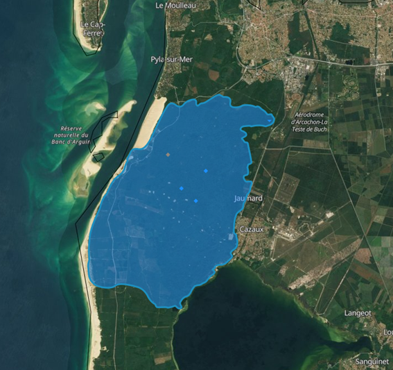
Maps for the three fires shown below demonstrate the 27000 hectares burnt.


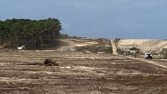
The Landiras 1 and La Teste-de-Buch fire were simultaneous fires. The one in La Teste-de-Buch occurred in a very touristy and peri-urban zone with large campsites requiring the evacuation of 6000 tourists and more than 30000 inhabitants, including difficult areas with a zoo and restaurants. A massive fire-break was set up at the southern limit of the fire (figure 4) but tactical fires were able to stop the fire progression 4km before the fuel break and limited the burnt area to 7000ha.
The Landiras 1 fire developed in a rural area, dominated by forest. Many villages had to be evacuated (8000 inhabitants from Landiras, Budos, Balizac, ..) and it burned an area of 13800 ha.
About 20km of tactical fires and 1km of backfires were used in July on the two fires and were able to control the fire spread. About 1700 firefighters were involved and 6 aircraft.
Surprisingly, on the 10th of August the fire at Landiras had been reactivated (Landiras 2) on a 2km front with extreme heat and covered an unbelievable area of 6000 ha in one night, requiring massive resources coordinated by SDIS 33 (1300 firefighter and 100 fire trucks) to stop it before it crossed the highway to Spain in one of the busiest week-ends of the summer. 12500 persons weren evacuated. The total area burnt from the Landiras 2 fire is 7400 ha.
September remaining very warm, an other area of 3400ha was burnt in the region of Saumos (north west of Bordeaux) after the fire started on the 12 of september. 1800 persons were evacuated and the fire lasted 3 days.
The wildfires that occurred in Aquitaine this summer resulted from very unusual extremely dry and hot weather that may occur more often in the future demonstrating that some structural changes in the forest structure are needed. These mega-fires are attracting more than normal attention and questions from the public about maritime pine management in France and will need to be considered when planning post fire restoration.
Some of tasks planned by FIRE-RES are aimed at addressing landscape structure, adjusting land use to limit the continuity of the fuel load and taking advantage of existing infrastructure (e.g. roads, railway lines, powerlines, etc.). This work will be possible thank to use of the latest modeling tools developed by INRAe and Canadian colleagues, which are already in use by fire emergency services. These tools will be also useful to improve the design of the forest/urban areas interface, reinforcing the importance of existing fire-break rules, and allow recommendations for urban planning and insurance schemes.
Christophe Orazio, IEFC
